
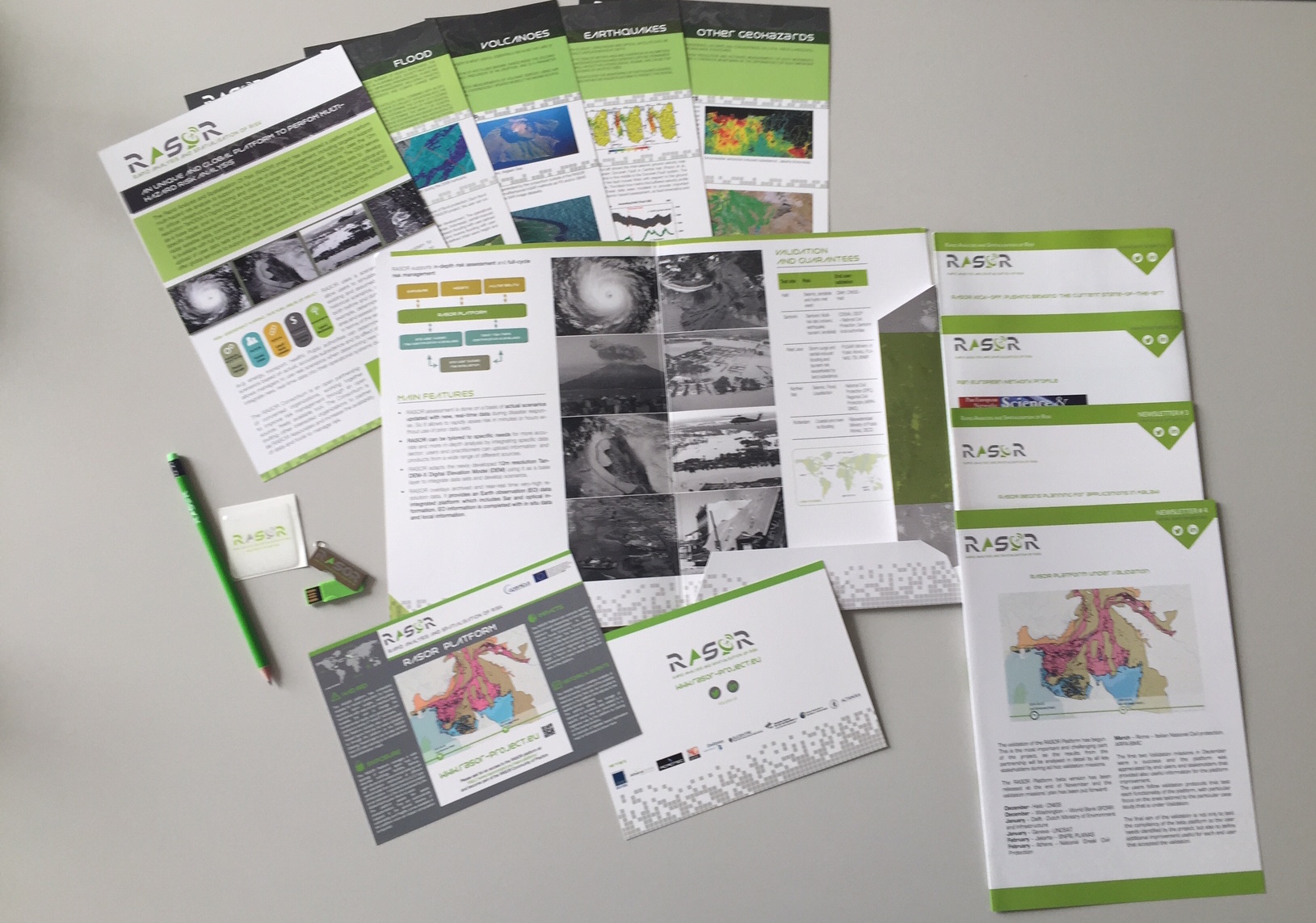
Dissemination Materials
1) PROJECT OVERVIEW PRESENTATION
Rasor Overview
2) PRESENTATION TEMPLATES
3) INFORMATIVE POSTERS
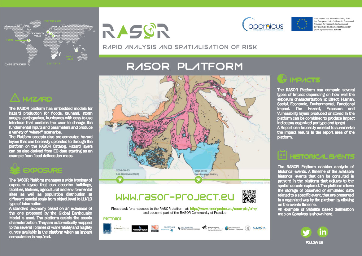
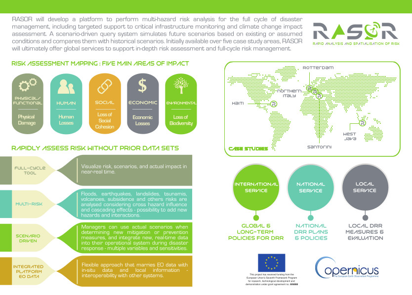
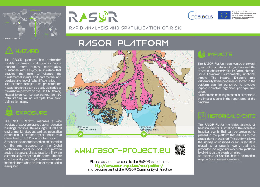
Informative poster #1
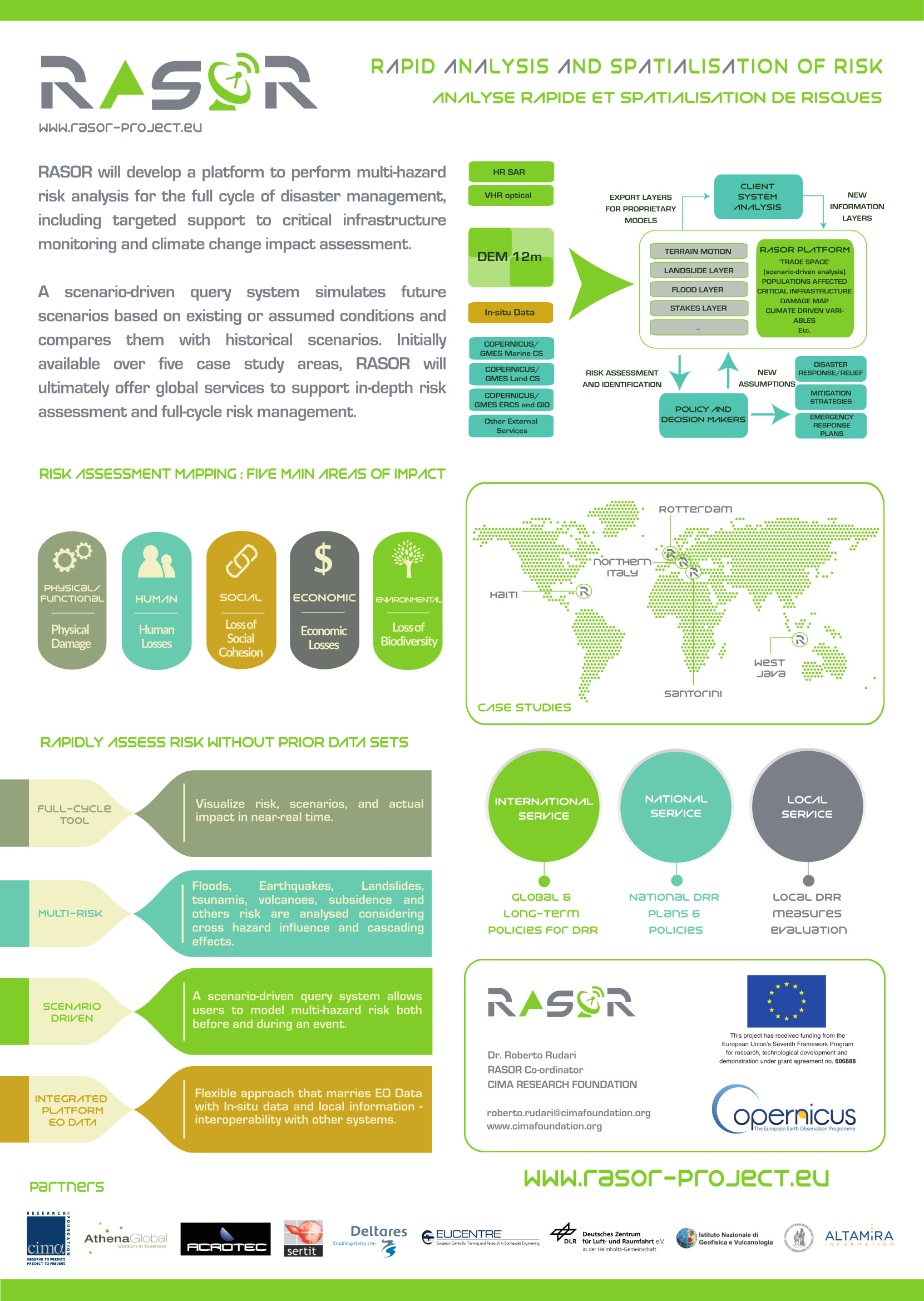
Informative poster #2
4) INFOGRAPHICS
Infographics #1
Infographics #2
5) NEWSLETTERS
Newsletter#1
CONTENT:
Read newsletter #1 >>
- RASOR Kick-off – pushing beyond the current state-of-the-art
- A Platform for Interactive Multi-risk Scenarios
- Applying RASOR to operational challenges – a quick look at RASOR end users
- RASOR Advisory Board – high-level advice to keep RASOR on track
Read newsletter #1 >>
Newsletter#2
CONTENT:
Read newsletter #2 >>
- Pan European Network Profile
- RASOR @ the EGU General Assembly 2015
- The 3rd World Conference on Disaster Risk Reduction (WCDRR), 14-18 March 2015, Sendai, Japan
- RASOR makes an agreement with Airbus Defence and Space on the use of TanDEM-X
- RASOR presented at the Copernicus Emergency projects Workshop 4 December 2014, REA
- RASOR team heads to Indonesia to meet with end users and develop joint vision for RASOR roll-out in Indonesia.
Read newsletter #2 >>
Newsletter#3
CONTENT:
Read newsletter #3 >>
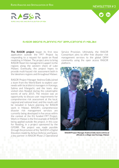
- RASOR begins planning for applications in Malawi
- RASOR User Workshop a clear success
- RASOR Platform
- The SME Workshop
Read newsletter #3 >>
Newsletter#4
CONTENT:
Read newsletter #4 >>
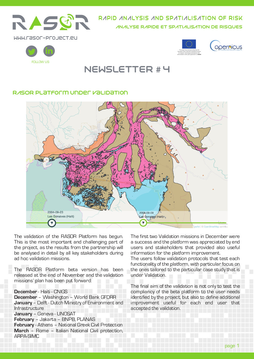
- RASOR Platform Under Validation
- RASOR session @EGU2016
- RASOR explores possibilities for African case study areas
- RASOR participates in the CDEMA’s Knowledge Marketplace
- RASOR SME Workshop concludes with strong interest from new partners
Read newsletter #4 >>
Newsletter#5
CONTENT:
Read newsletter #5 >>
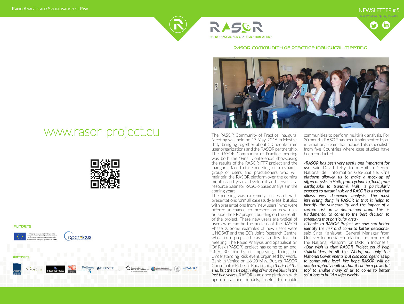
- RASOR Community of Practice Inaugural meeting
- RASOR EC Workshop in Brussels
- RASOR @CUF
- Living Planet Symposium 2016
Read newsletter #5 >>
6) Articles
Contributions to scientific Conferences or Journals:
- Rossi, L.; Koudogbo F. N.; Duro J.; Rudari R.; Eddy A. (2014), Multi-hazard risk analysis using the FP7 RASOR Platform, DOI: 10.1117/12.2067444 Conference: SPIE Remote Sensing for Agriculture, Ecosystems, and Hydrology, Volume: 92390J
- Koudogbo F. N.; Duro J.; Huber M.; Rudari R.; Eddy A.; Lucas R. (2014), An assessment of TanDEM-X GlobalDEM over rural and urban areas, Proc. SPIE 9243, SAR Image Analysis, Modeling, and Techniques XIV, 92430M; doi:10.1117/12.2067463
- Harb, Mostapha, Fabio Dell’Acqua, and Daniele De Vecchi. “Multi-risk buildings exposure and physical vulnerability mapping from optical satellite images: Developing an integrated toolset.” Geoscience and Remote Sensing Symposium (IGARSS), 2014 IEEE International. IEEE, 2014.
- Harb, Mostapha, Daniele De Vecchi, and Fabio Dell’Acqua. “A novel approach to co registering multi-temporal remotely sensed data in a vulnerability monitoring framework.” EGU General Assembly Conference Abstracts. Vol. 16. 2014.
- D. De Vecchi, M. Harb, F. Dell’Acqua (2014). Refining registration of large, multi-temporal stacks of medium-resolution images: a novel, automated approach for “Big Heritage Data”. Proc. of the 2014 conference on Big Data from Space (BiDS’14) 326- 329, In:2014 conference on Big Data from Space (BiDS’14). 12–14 November 2014, European Space Agency-ESRIN Frascati, Italy,
- Mostapha Harb, Daniele De Vecchi, Fabio Dell’Acqua. “PHYSICAL VULNERABILITY PROXIES FROM REMOTE SENSING: REVIEWING, IMPLEMENTING AND DISSEMINATING SELECTED TECHNIQUES”. Accepted for publication on IEEE Geoscience and Remote Sensing Magazine.
- Roberto Rudari and the RASOR Team. RASOR Project: Rapid Analysis and Spatialisation
of Risk, from Hazard to Risk using EO data. Abstract at EGU 2015. - Eva Trasforini, Silvia De Angeli, Mattia Fiorini, Lauro Rossi, and Roberto Rudari. Use of crowd source, Open Data and EO-based information in flood damage assessment: the 2014 urban flood in Genoa. Abstract at EGU 2015.
- D. De Vecchi, M. Harb, F. Dell’Acqua: “An integrated, open-source set of tools for urban vulnerability monitoring from Earth observation data”. Abstract at EGU 2015.
- Joost Beckers, Lora Buckman, Daniel Bachmann, Martijn Visser, Daniel Tollenaar, Deepak Vatvani, Nienke Kramer, and Neeltje Goorden. RASOR flood modelling. Abstract at EGU 2015.
- Daniel Bachmann, Dirk Eilander, Annemargreet de Leeuw, Ferdinand Diermanse, Albrecht Weerts, Karin de Bruijn, Joost Beckers, Leonore Boelee, Emma Brown and Caroline Hazlewood Fews-Risk: A step towards risk-based flood forecasting. Abstract at EGU 2015.
- Martin Huber, Birgit Wessel, Anna Wendleder, Jörn Hoffmann, Achim Roth. A framework for an automatical editing of TanDEM-X digital elevation models. Proceedings of IGARSS 2015, pp. 3826-2829, 2015.
- Lauro Rossi, Roberto Rudari and the RASOR Team. RASOR Project: Rapid Analysis and Spatialisation of Risk, from Hazard to Risk using EO data. Abstract at EGU 2016.
- Tholey N., Yesou H., Maxant J., Montabord M., Studer M., Faivre R., Rudari R., and de Fraipont P. Cross exploitation of geo-databases and earth observation data for stakes characterization in the framework of multi-risk analysis and management: RASOR examples. Abstract at EGU 2016.
- Daniele De Vecchi and Fabio Dell’Acqua. Steering Landsat-oriented, open-source risk-mapping tools towards Copernicus: tuning parameters on Sentinel-2 data. Abstract at EGU 2016.
- Ordoqui, Patrick, Mora, Oscar, Koudogbo, Fifamè Nadège, Ganas, Athanassios. Sentinel-1 TOPSAR Interferometry with the DIAPASON InSAR software. ESA Living Planet Symposium 2016.
- Fifamè Nadège Koudogbo, Andrew Eddy, Roberto Rudari, Lauro Rossi, Eva Trasforini, Joost Beckers, Martin Huber, Stefano Salvi, Hervé Yésou, Fabio Dell’acqua, Athanassios Ganas. Rapid Analysis and Spatialisation of Risk – changing the paradigm of informed risk decision-making. ESA Living Planet Symposium 2016.
- Lauro Rossi, Eva Trasforini, Roberto Rudari, Andrew Eddy. Impact assessment on global scale with the RASOR platform. ESA Living Planet Symposium 2016.
- Cristiano Tolomei, Stefano Salvi, Alessandro Lugari, Joost Beckers, Martin Huber, Giuseppe Pezzo. Multitemporal InSAR data to develop natural hazard scenarios for the Bandung area (Western Java, Indonesia). ESA Living Planet Symposium 2016.
- Bachmann D., Eilander D., de Leeuw A., de Bruijn K., Diermanse F., Weerts A., Beckers J., Boelee L., Hazlewood C., Brown E. Prototypes of risk-based flood forecasting systems in the Netherlands and Italy. Accepted for oral presentation at FloodRisk2016 Conference (Lyone).
- Roberto Rudari, Joost Beckers, Silvia De Angeli, Lauro Rossi, Eva Trasforini. Impact of modelling scale on probabilistic flood risk assessment: the Malawi case. Accepted for oral presentation at FloodRisk2016 Conference (Lyone).
Contributions to Scientific Dissemination Journals:
- RASOR Rapid Analysis and Spatialisation of risk: “Into Space” EU Space Research Space; Research projects under the 7th Framework Programme for Research (6th call)
- Roberto Rudari and Andrew Eddy (2014): INNOVATION IN RISK ASSESSMENT: The Rapid Analysis and Spatialisation of Risk (RASOR) offers a powerful tool to integrate data and products for rapid risk analysis, Pan European Networks: Science & Technology, issue 11;
- Rudari Roberto (2014): “RASOR Sharp: RASOR’s Dr. Roberto Rudari tells PEN about how the project will build on existing technologies to provide a comprehensive crisis management platform”, Pan European Networks: Science & Technology, issue 12; www.paneuropeannetworks.eu
- Rudari Roberto (2015): “RASOR First Release: The Cima foundation’s Roberto Rudari discusses the objectives of the Rasor Project, a platform to perform multi-hazard risk analysis”, Pan European Networks: Science & Technology, issue 16; www.paneuropeannetworks.eu
- Roberto Rudari and Andrew Eddy (2016): “The CIMA Foundation.s Roberto Rudari and Athena Global’s Andrew Eddy discuss the RASOR platform, ann innovation which is breaking new ground towards an increased understanding of risk”, Pan European Networks: Science & Technology, issue 19; www.paneuropeannetworks.eu.
7) EVENTS KIT
Rasor event’s kit is composed by a folder containing informative material on the project (newsletter and infographics), paper notes, a pencil, a USB PEN and a STICKER.
- 2014 Global Flood Partnership Annual Meeting, READING, UK, 6 March 2014 – PRESENTATION
- IDRC, DAVOS 2014, “Integrative Risk Management – The role of science, technology & practice” 24 – 28 August 2014 | Davos, Switzerland – PRESENTATION
- IEEE IGARSS 2014, Quebec, Canada July 13-18 2014 – PRESENTATIONS
- Understanding Risk Forum 2014, June 30-July 4, London, UK, GFDRR – WB, UNISDR, RMS. – PRESENTATION
- Understanding Risk Forum HAITI, 13-19 July, port au prince, Haiti – FULL RASOR SESSION
- The 3rd World Conference on Disaster Risk Reduction (WCDRR), 14-18 March 2015, Sendai, Japan. – PRESENTATION, IGNITE PRESENTATION (VIDEO)
- European Geosciences Union General Assembly 2015 Vienna, Austria: 12 – 17 April 2015 – FULL RASOR SESSION already prepared
- European Civil protection Forum 2015, 6-7 May, Brussels
